
- Services
- Sectors
All Sectors
- Aerospace and Defence
- Agriculture
- Automotive
- Building, Properties and Real Estate
- Consumer Products
- Finance
- Healthcare
- Highways
- Hospitality and Leisure
- Housing
- Insurance
- Manufacturing
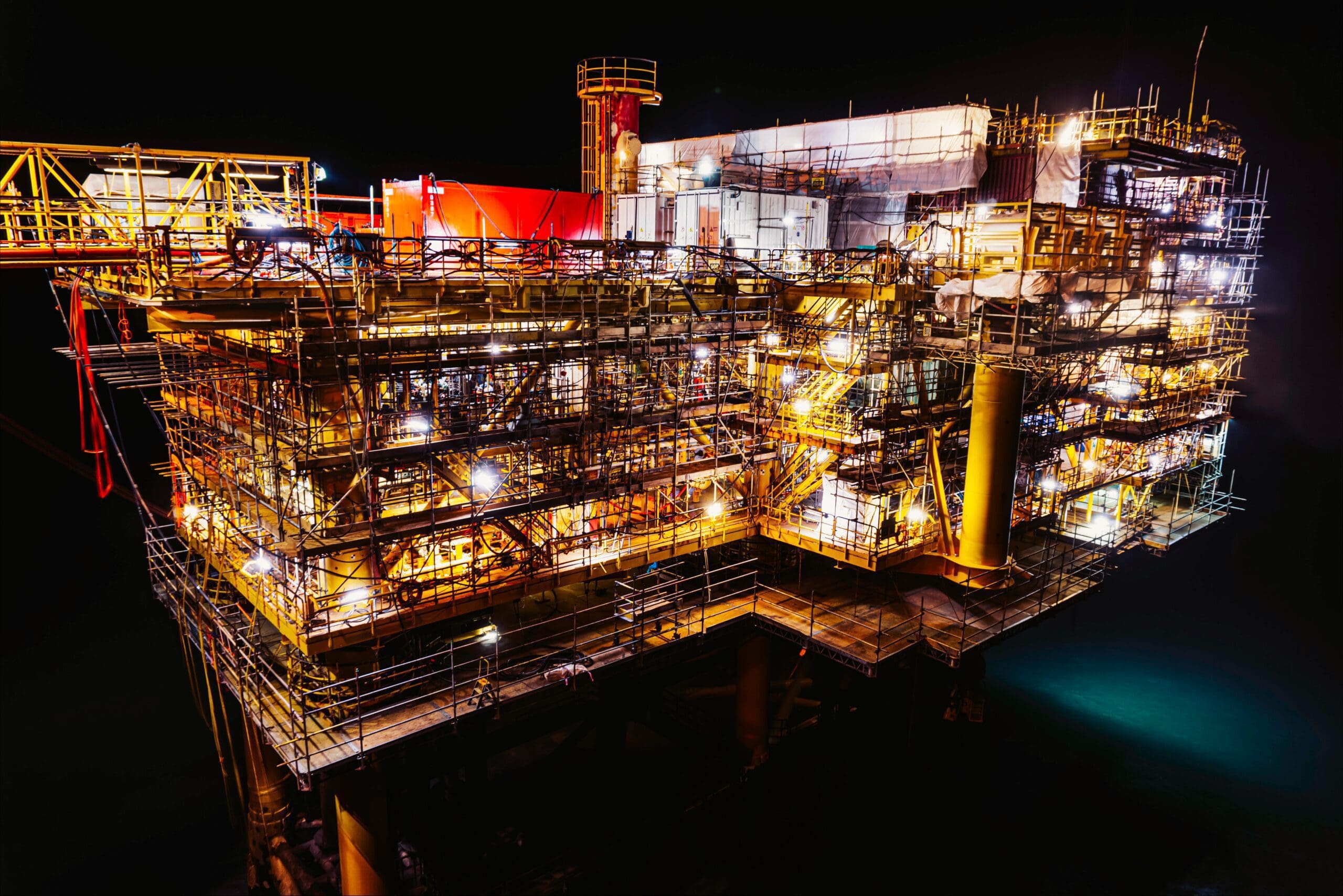
- Marine and Offshore
- Petrochemicals, Oil and Gas
- Power and Utilities
- Rail
- Renewables
- Retail
- Transport, Logistics and Distribution Centres
- Not seeing your sector?Message us to see how we can support you.
- Brokers
- Case Studies
- News
- About
 About BES Group
 Accreditations & Credentials
 Our Environmental, Social & Governance
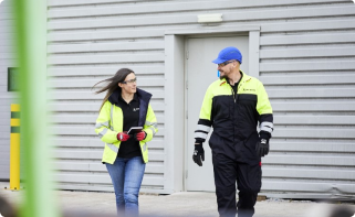 Careers at BES Group
 Our Senior Leadership Team
Infrastructure Engineering Solutions
Digital Surveys and Remote Asset Monitoring Solutions
A leading provider of Digital Survey solutions for infrastructure projects, across various environments and locations
Explore our process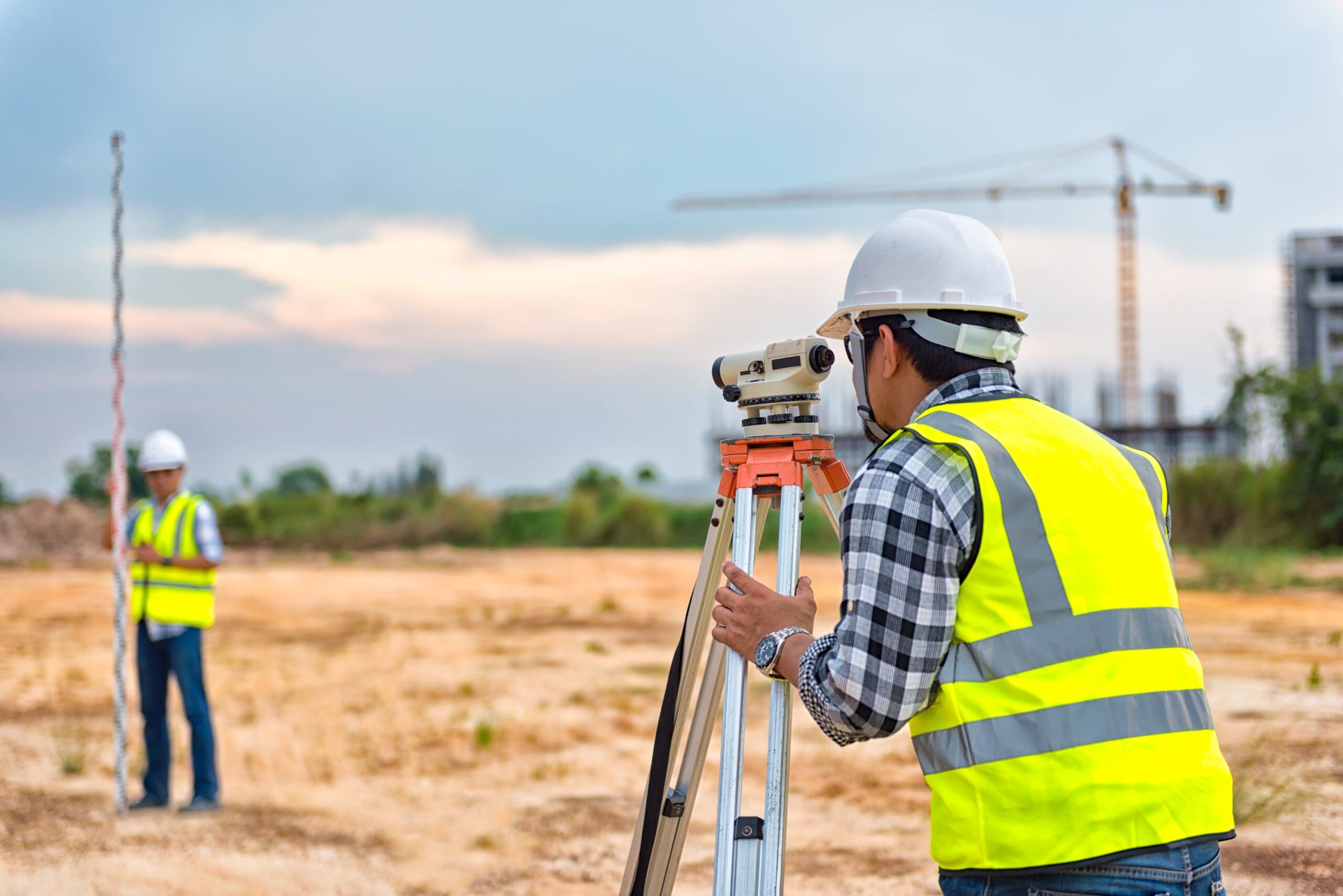
Interested? Let’s talk.
Send us an enquiry
Who we’ve partnered with...
A snapshot of our Digital Surveys and Remote Asset Monitoring Services
Our Digital Surveys and Remote Asset Monitoring services are tailored to your unique operations and environment. We provide expertise in precision land mapping, real-time asset tracking, and advanced data analytics for enhanced operational. We provide a bespoke solution to ensure that every detail is accounted for, even in the most challenging environments.
Digital Surveys and Remote Asset Monitoring solutions tailored to your specific needs.
We understand that every survey environment is different and work with you to ensure each survey is tailored to your project requirements. We specialise in Topographical, Bathymetric, and Sonar Imaging Surveys to provide precision and reliability for your operations. Our expert team provides comprehensive, high-precision digital surveying in the most challenging locations, including remote access locations and marine environments.
We survey a variety of infrastructure, such as:
- Land and topographical features
- Underground utilities and piping
- Civil and structural assets
- Marine and underwater infrastructure
- Railway tracks and associated infrastructure
- Highway and road networks

Preserving History and Ensuring Safety with Structural Monitoring During The Jenners Building Re-development
Remote Structural Monitoring System

A proactive solution for Twerton’s Sluice Gates
Assuring structural safety for years to come for Mythe Bridge
Let's talk about Digital Surveys
Send one of the team a message
Not seeing what you expected?
Try using our search


Alcumus ISOQAR
We're proud to have received SafeContractor accreditation from Alcumus ISOQAR, an industry leader in safety and quality management solutions, enhancing our expertise as a construction contractor for electrical services, pressure systems services, and the meticulous inspection and examination of lifting equipment.
Legal entities:
- British Engineering Services Limited
- British Engineering Services Asset Reliability Ltd.
- BES Group Electrical Ltd.
Alcumus ISOQAR
Alcumus helps businesses of all sizes safeguard their people, operations, and the environment by providing a unified approach to managing Health, Safety, and Environmental, Social, and Governance (ESG) issues. Their services span industries, locations, contractor networks, and supplier chains. By partnering with Alcumus, we're equipped to deliver industry-leading services to our customers.
Legal entities:
- BES Group Testing Ltd.
- British Engineering Services Asset Reliability Ltd.
- Notus Heavy Lift Solutions Ltd.
- XEIAD
Alcumus ISOQAR
Alcumus helps businesses of all sizes safeguard their people, operations, and the environment by providing a unified approach to managing Health, Safety, and Environmental, Social, and Governance (ESG) issues. Their services span industries, locations, contractor networks, and supplier chains. By partnering with Alcumus, BES Group and its testing, asset reliability, heavy lifting, and infrastructure divisions are equipped to deliver industry-leading services to our customers.
Legal entities:
- BES Group Testing Ltd.
- British Engineering Services Asset Reliability Ltd.
- Notus Heavy Lift Solutions Ltd.
- XEIAD
- British Engineering Services Asset Reliability Mimic Ltd.
Alcumus ISOQAR
Alcumus helps businesses of all sizes safeguard their people, operations, and the environment by providing a unified approach to managing Health, Safety, and Environmental, Social, and Governance (ESG) issues. Their services span industries, locations, contractor networks, and supplier chains. By partnering with Alcumus, we're equipped to deliver industry-leading services to our customers.
Legal entities:
- Notus Heavy Lift Solutions Ltd.
- XEIAD
- British Engineering Services Asset Reliability Ltd.
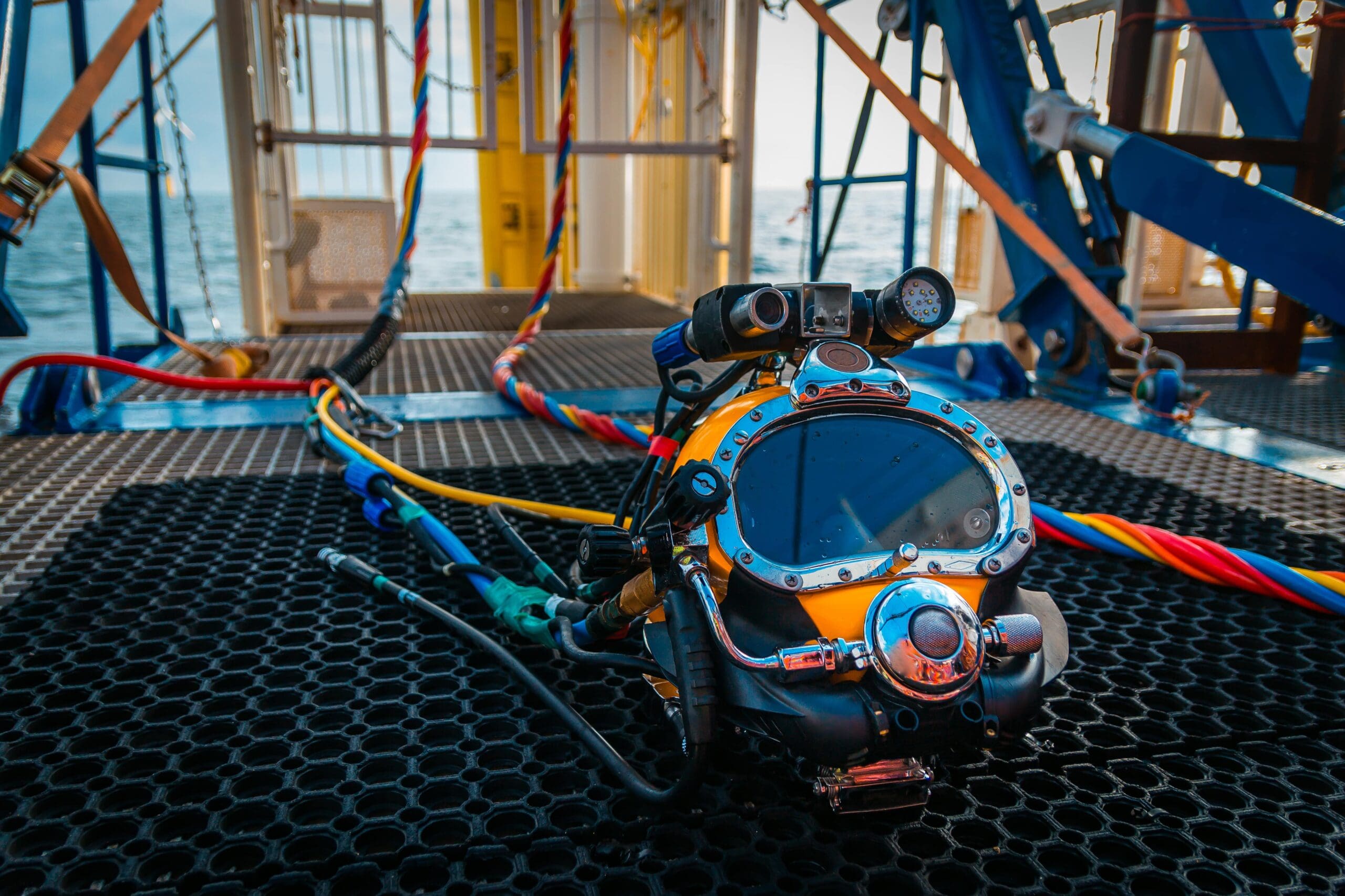
Association of Diving Contractors
ADC supports and encourages best practice within the diving sector and actively promotes the common interests of diving contractors and others associated with commercial diving, as well as seeking improvements in health, safety, environment & technical standards. By being a member of the Association of Diving Contractors, we are reinforcing our expertise and elevating our service quality when it comes to difficult access solutions.
Legal entities:
- XEIAD Ltd
- Inspire Structures Ltd
Keolis Amey
Keolis is a multinational transportation company that operates public transport systems. It manages bus, rapid transit, tram, coach networks, rental bikes, car parks, water taxi, cable car, trolleybus, and funicular services. By being a member of their preferred supplier scheme, we're highlighting our commitment to providing critical services to our nation's crucial infrastructure.
Legal entities:
- XEIAD
RISQS
The Railway Industry Supplier Qualification Scheme (RISQS) is a recognised industry-wide system for assessing and qualifying suppliers to the UK rail sector. By choosing them, we're demonstrating our commitment to safety, quality, and compliance in the rail industry.
Legal entities:
- XEIAD Ltd
- British Engineering Services Asset Reliability Ltd
- British Engineering Services Asset Reliability Strainstall Ltd
- Inspired Access Ltd
- Inspire Structures Ltd
SafeContractor Approved
SafeContractor is a leading health and safety pre-qualification scheme that helps businesses manage supply chain risks. By aligning ourselves with them, we're demonstrating our commitment to health and safety.
Legal entities:
- BES Group Electrical Ltd.
- XEIAD
- British Engineering Service Limited
Explore what our clients say
Our Digital Surveys process
Speak to us about the processA typical Digital Survey and Remote Asset Monitoring Service may include the following steps.
Sectors we service
Dive into the diverse landscapes where BES Group sparks innovation and drives impact.


About Digital Surveys and Remote Asset Monitoring
Explore Digital Surveys- Topographical Surveys
- Bathymetric Surveys
- Sonar Surveys
- Acoustic Imaging
- Proud to specialise in Digital Surveys across challenging environments
- Key benefits of Digital Surveys and Remote Asset Monitoring
Our Topographical Digital Surveys provide accurate and detailed maps of your land surface, supporting you with all stages of your project.
From coordinates for bridges to detailed Digital Land Surveys for sewerage outfalls, our specialists are experienced in a wide range of construction operations.
We use various systems and survey types to prepare your technical drawings, ensuring they’re tailored to your project, including:
- Complex engineering surveying
- Structural monitoring
- Traditional Topographic Surveys
- Railway surveys
- 3D point cloud scanning and modelling
- BIM modelling
- Setting out
- 3D CAD modelling and visualisations
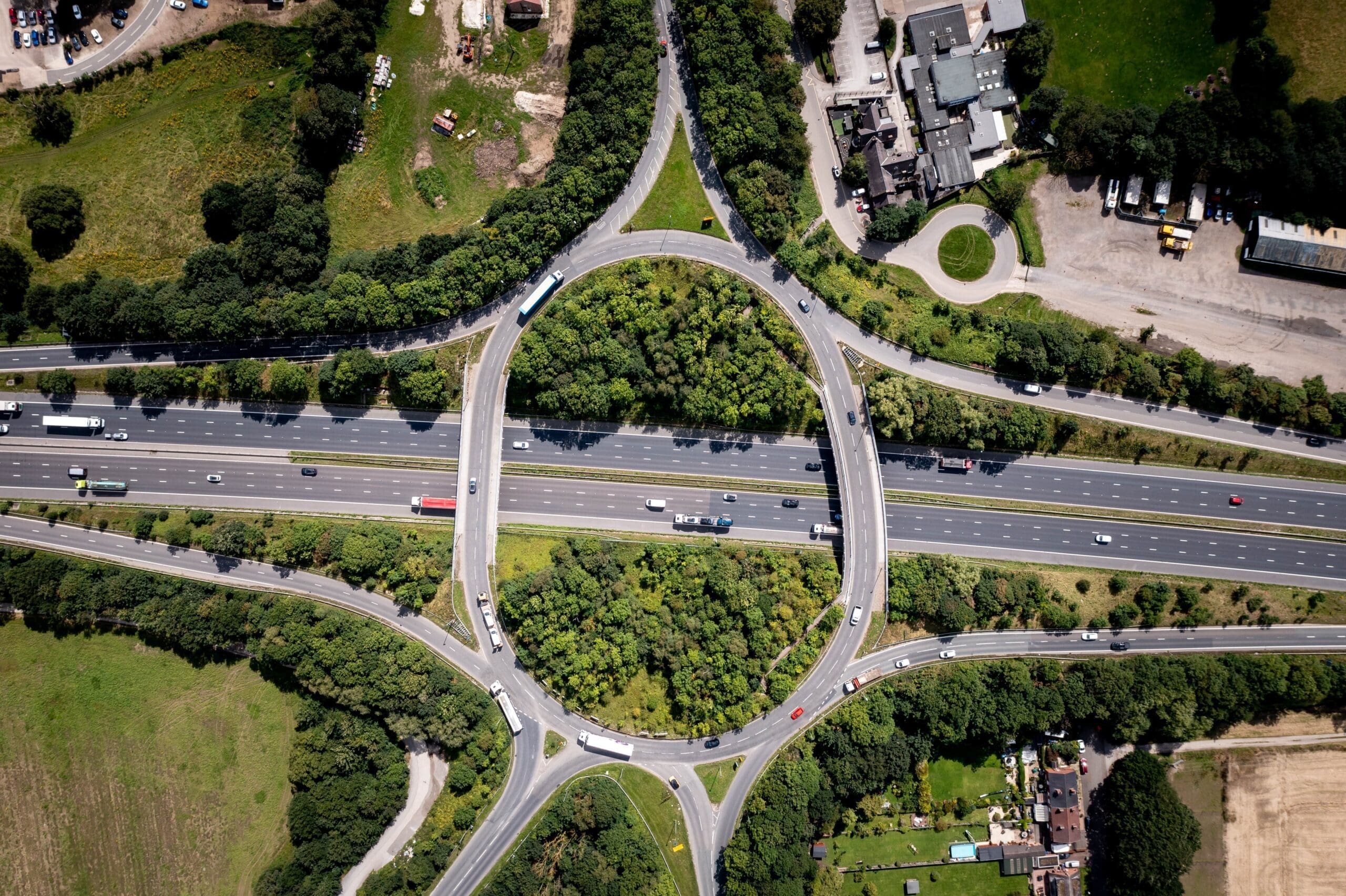
Our Bathymetric Surveys and underwater scour inspections accurately plot your seafloor, creating precise nautical charts for every project stage.
We use various survey techniques to record riverbed profiles and monitor their development over time, giving valuable data to understand riverbed behaviours.
Our survey teams use standard topographical survey techniques, plus GPS-based survey equipment with depth sounders. For example, we may use a standard ranging rod with a GPS receiver, or an echo sounder attached to a boat. We can also provide remote marine asset monitoring to detect scour, which is conducted following BA 74/06 guidelines.
Sonar Surveys offer comprehensive mapping of underwater structures, such as bridges, and pipelines which may need inspecting more closely.
These surveys construct detailed images to specifically assess structure condition, even in the most complex environments.
We use MS1000 software for sonar data which correlates to known geographic coordinates or a relative grid. GPS provides the accuracy needed for positioning the sonar and allows the operator to record targets with associated coordinates effectively. All exported data will be tailored to your unique requirements, including geo-referenced survey plots, images, and defects.
Acoustic Imaging is a non-invasive survey method used to detect and map sound waves within infrastructure, such as vibrations.
It involves the use of a microphone to identify ultrasound and produce real-time images of sound waves that may be undetectable without the use of technology.
This can help provide insight into potential issues such as gas and air leaks within a structure, as the sound is mapped in real-time this allows engineers to precisely identify the location of the structural issue.
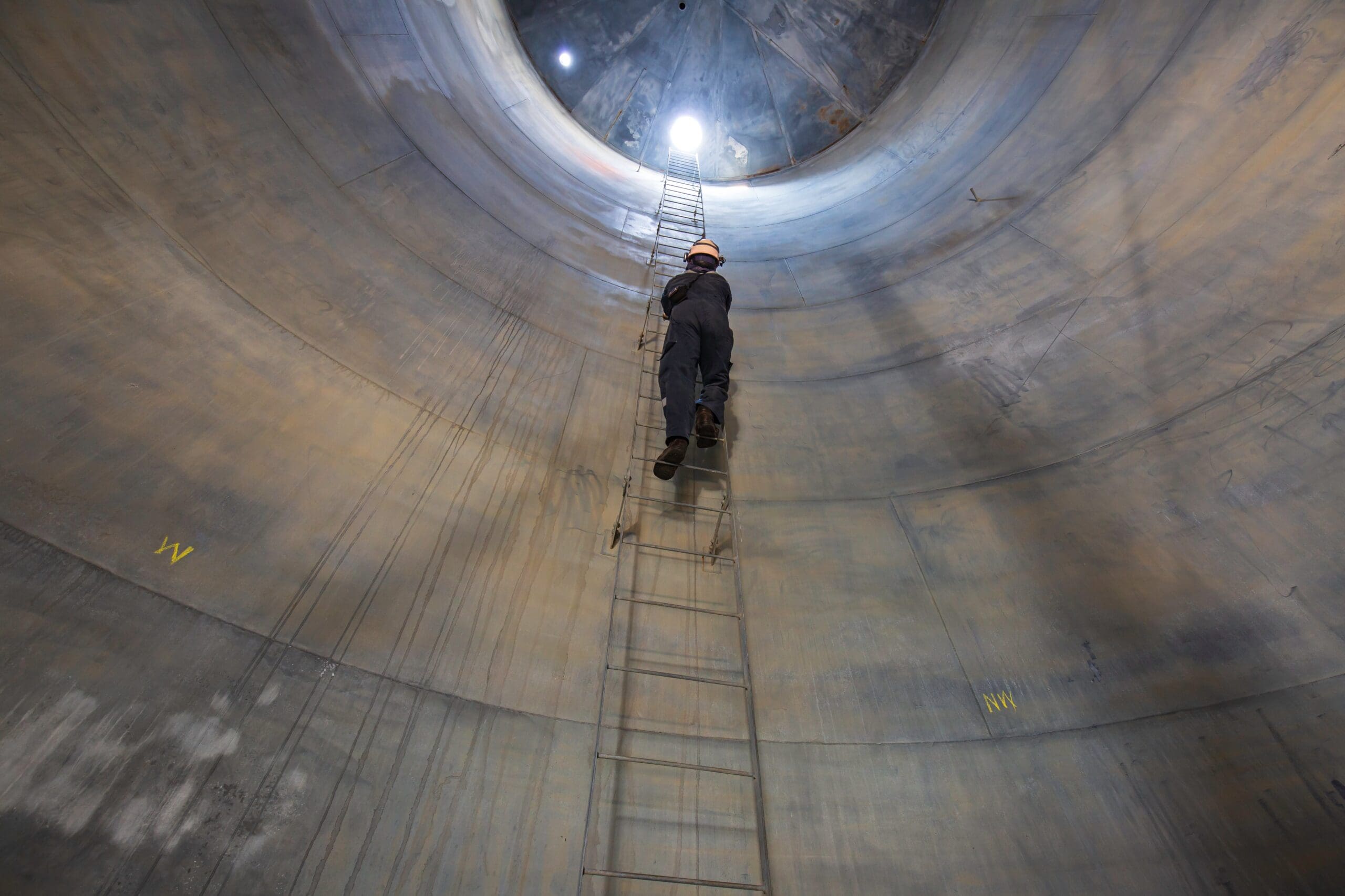
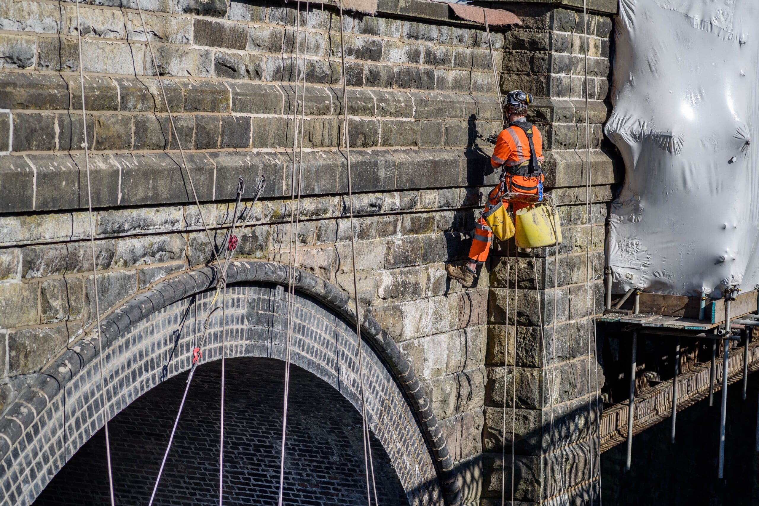
Our team has extensive expertise in Special Access Support systems such as Rope Access, Confined Space Entry, and underwater inspection techniques – so we can reach structures that would be difficult to access.
We work across a variety of sectors including railways, highways, large construction sites and civil structures. Regardless of your environment or your environment and Digital Surveying needs, we’re here to support you.

Technological innovation
Specialist technology means we can provide you with precise and efficient data, even in remote or hazardous settings. This includes unmanned aerial vehicles (UAVs), underwater sonar, and other cutting-edge Digital Surveying techniques engineered for complex environments.
Precise data
Our leading Digital Surveys gather unique and rigorous insights into every stage of your project. We deliver data with convenience using our online reporting method, ensuring that results and analysis are bespoke to the demands of your construction environment.
Preventative measures
One of the main benefits of our Digital Surveys is that we uncover vital data about your project to advise on potential maintenance, repair, and planning works. This helps you identify potential issues before they arise, minimising downtime and unplanned costs.
-
Topographical Surveys
Our Topographical Digital Surveys provide accurate and detailed maps of your land surface, supporting you with all stages of your project.
From coordinates for bridges to detailed Digital Land Surveys for sewerage outfalls, our specialists are experienced in a wide range of construction operations.
We use various systems and survey types to prepare your technical drawings, ensuring they’re tailored to your project, including:
- Complex engineering surveying
- Structural monitoring
- Traditional Topographic Surveys
- Railway surveys
- 3D point cloud scanning and modelling
- BIM modelling
- Setting out
- 3D CAD modelling and visualisations
-
Bathymetric Surveys
Our Bathymetric Surveys and underwater scour inspections accurately plot your seafloor, creating precise nautical charts for every project stage.
We use various survey techniques to record riverbed profiles and monitor their development over time, giving valuable data to understand riverbed behaviours.
Our survey teams use standard topographical survey techniques, plus GPS-based survey equipment with depth sounders. For example, we may use a standard ranging rod with a GPS receiver, or an echo sounder attached to a boat. We can also provide remote marine asset monitoring to detect scour, which is conducted following BA 74/06 guidelines.
-
Sonar Surveys
Sonar Surveys offer comprehensive mapping of underwater structures, such as bridges, and pipelines which may need inspecting more closely.
These surveys construct detailed images to specifically assess structure condition, even in the most complex environments.
We use MS1000 software for sonar data which correlates to known geographic coordinates or a relative grid. GPS provides the accuracy needed for positioning the sonar and allows the operator to record targets with associated coordinates effectively. All exported data will be tailored to your unique requirements, including geo-referenced survey plots, images, and defects.
-
Acoustic Imaging
Acoustic Imaging is a non-invasive survey method used to detect and map sound waves within infrastructure, such as vibrations.
It involves the use of a microphone to identify ultrasound and produce real-time images of sound waves that may be undetectable without the use of technology.
This can help provide insight into potential issues such as gas and air leaks within a structure, as the sound is mapped in real-time this allows engineers to precisely identify the location of the structural issue.
-
Proud to specialise in Digital Surveys across challenging environments
Our team has extensive expertise in Special Access Support systems such as Rope Access, Confined Space Entry, and underwater inspection techniques – so we can reach structures that would be difficult to access.
We work across a variety of sectors including railways, highways, large construction sites and civil structures. Regardless of your environment or your environment and Digital Surveying needs, we’re here to support you.
-
Key benefits of Digital Surveys and Remote Asset Monitoring
Technological innovation
Specialist technology means we can provide you with precise and efficient data, even in remote or hazardous settings. This includes unmanned aerial vehicles (UAVs), underwater sonar, and other cutting-edge Digital Surveying techniques engineered for complex environments.

Precise data
Our leading Digital Surveys gather unique and rigorous insights into every stage of your project. We deliver data with convenience using our online reporting method, ensuring that results and analysis are bespoke to the demands of your construction environment.

Preventative measures
One of the main benefits of our Digital Surveys is that we uncover vital data about your project to advise on potential maintenance, repair, and planning works. This helps you identify potential issues before they arise, minimising downtime and unplanned costs.
Frequently asked questions
What is a Digital Survey of land?
A Digital Land Survey is technology used to measure and map land features. It often combines techniques such as GPS, drones, and 3D scanning to collect data about an area of land.
This data can then be used to inform construction planning, such as locating and marking boundaries, identifying elevation levels, or mapping areas of high risk.
This is relevant for:
- Aerospace, airport and runway design.
- Defence, military base and facility planning, border and perimeter security.
- Marine, coastal management and port and harbour design.
- Construction and civil engineering.
- Transportation and infrastructure.
- Urban planning and development.
- Environmental management and conservation.
Who can conduct a Digital Survey?
You must be an appropriately qualified Digital Surveyor to conduct a survey, as there are important regulations and guidelines to follow.
For example, for scour assessments, survey specialists should comply with BA 74/06 guidelines.
What technology is used in a Digital Survey?
Digital Surveys typically combine GPS, drones, 3D scanning, MS1000 software, and CAD software to produce assessments. This innovative technology allows experts to accurately map land and structures, so they can produce in-depth, reliable reports on size, condition, risk, and other factors.
How long does it take to complete a Digital Survey?
The time to complete a Digital Survey is dependent on many factors, including the environment and complexity, type of project, location, and method. Learn more about Structural Inspections and Surveys to see what’s best for your project.
How does Remote Asset Monitoring work?
Remote Asset Monitoring uses sensors, IoT devices, and communication networks to track assets from a distance. These sensors collect real-time data on the asset’s condition, location, and performance, and send it to a central system.
You can then use this system to view data, helping to inform decision-making and ongoing maintenance and management.
Can Remote Asset Monitoring help with predictive maintenance?
Remote Asset Monitoring supports predictive maintenance by continuously collecting data on asset performance and condition. For example, with large bridges, you can analyse this data to identify patterns and anomalies to predict potential bridge failures before they occur. This allows for timely maintenance, reducing downtime and unplanned repair costs.
Which type of assets can be monitored remotely?
You can monitor many types of construction assets remotely. These include:
- Heavy machinery
- Vehicles
- Tools and equipment
- Materials, such as steel and concrete supplies.
- Site infrastructure, such as bridges and buildings.
- Environmental conditions, including weather.
- Underwater structures and riverbeds.
Let’s talk. Ask us anything.
Send one of the team a message
Insights & news
Browse our latest articles
Other similar services...
Looking for something else? Explore similar services...
Let’s get you to the right person, fast.
Thank you, enquiry submitted!
Please check your inbox. We have sent you an email receipt of your enquiry.
We treat every enquiry with the upmost urgency. We’ll aim to get in touch with the relevant BES Group specialist and get back to you as soon as possible*.
Thank you again and have a great day.